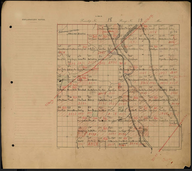
For genealogical research, there are two main components of land and property records: maps and documents. Using both, when they are available, is a great benefit to research. This is especially true because often the documents, especially in states using metes and bounds property descriptions, do not provide enough information to adequately physically locate the property. In most counties in the United States, Maps and documents are kept in different locations. Likewise, although there may be a digitized map of a digitized document, the digitized document and digitized map are seldom linked or indexed the same way.
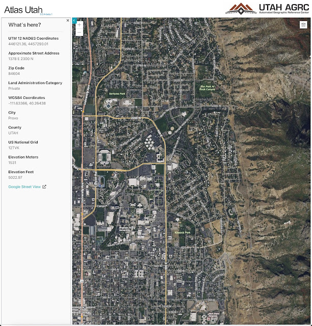
Online, you can find digital maps in a variety of formats for almost any location on the face of the earth. In the United States, most of the land has been mapped using the Geographic Information System Mapping or GIS. For example, the state of Utah has a Utah Mapping Portal that contains Most of the state-based Maps in the state of Utah. See gis.utah.gov
 |
| https://atlas.utah.gov/ |
These GIS maps have been incorporated into local tax assessment and real estate identification maps. You should be able to find similar maps for every state in the United States. Some of the GIS-based maps, such as the assessment maps for Utah Valley incorporate the ownership chain of title for the parcels shown.
The United States uses a fairly uniform system for recording land ownership. Based primarily on English common law with some exceptions based on Spanish law, a record of land ownership is maintained in the various counties across the country in a government agency usually called the “County Recorder.” The laws of all the states provide that land ownership is in some way dependent on giving notice to the world of the claim of ownership. This is usually done by filing or recording a copy of all deeds and other documents affecting property ownership or property title. Titled property is therefore any property requiring some type of formal government document (usually called the “title”) evidencing ownership.
As real property is sold, the changes of ownership are referred to as the “chain of title.” Genealogical research depends heavily on being able to identify the exact physical location of an event in ancestors’ lives. The need to be as exact as possible in identifying physical locations extends across the entire world but not every country has the records to support that level of research. Fortunately, the United States does. Land ownership has been assiduously recorded since colonial times. Even if the original deeds or other documents are lost or destroyed, the chain of title is so legally important that a tremendous effort will always be made to reconstruct any lost records as much as possible.
Here is a sample statement explaining the recording of title documents from the Washington County Recorder’s Office in Rhode Island.
A title search of real property is performed primarily to answer three questions :
- Does the seller or grantor have an interest in the property being transferred?
- Are there any restrictions pertaining to the use of the land (real covenants, easements, or other servitudes)?
- Is the property encumbered (mortgages, back taxes, mechanic’s liens, or other assessments)?
Anyone can do a title search. Recorded documents concerning conveyances of land are a matter of public record. These documents are maintained in hard copy format or scanned into image files by the recording office in the jurisdiction where the subject property is located. Each record is a document evidencing an event that occurred in the history of the property. When combined, these records create a chain of title for a specific piece of property. Performing a title search involves accessing the official land records provided by the county or jurisdiction.
Although the Recorder in this quote says that “Anyone can do a title search.” I did a complex title search just this past week, and I can say that without some extensive experience or training doing an adequate title search is way beyond the skill of the average researcher. Fortunately, you can pay people to do the search for you. In the east, these people are usually referred to as abstractors. In the west, title searches are primarily done by “title companies” that generally insure the accuracy of a “title report.” If they want to pay the price, genealogists can use these services to discover the “original” owner or owners of a real estate parcel.
Land ownership in the states that were originally English colonies is based on the “State Land System” of property ownership and description. During colonial times, the main and almost only method of describing real property by metes and bounds. The metes part of the description is the measurement of the land. The bounds part of the description are the physical features defining the boundary. There are a number of online programs that can produce a map of the property from a metes and bounds description if the description has compass directions.
The first step in finding any genealogically significant documents in including those of land and property is to identify a specific location of at least one event in your ancestors’ lives. If that is possible. The next step is to determine if the ancestors owned any land in the area. Then, the researcher needs to see if there are any deeds or other documents that identify the location. When you have the location, you can begin to search for a document such as a deed that will identify the exact land owned. Once you have a deed, you can go to any maps available to see if you can identify the exact location on a map. With the location as a starting point, you can then begin to look for other historical documents.
This may sound complicated because it is complicated.


